Explore › Old maps › The countries travelled by the Apostles
Open the map in full size (3000 × 2535)Library of Congress, Geography and Map Division · public domain Old maps · 1826
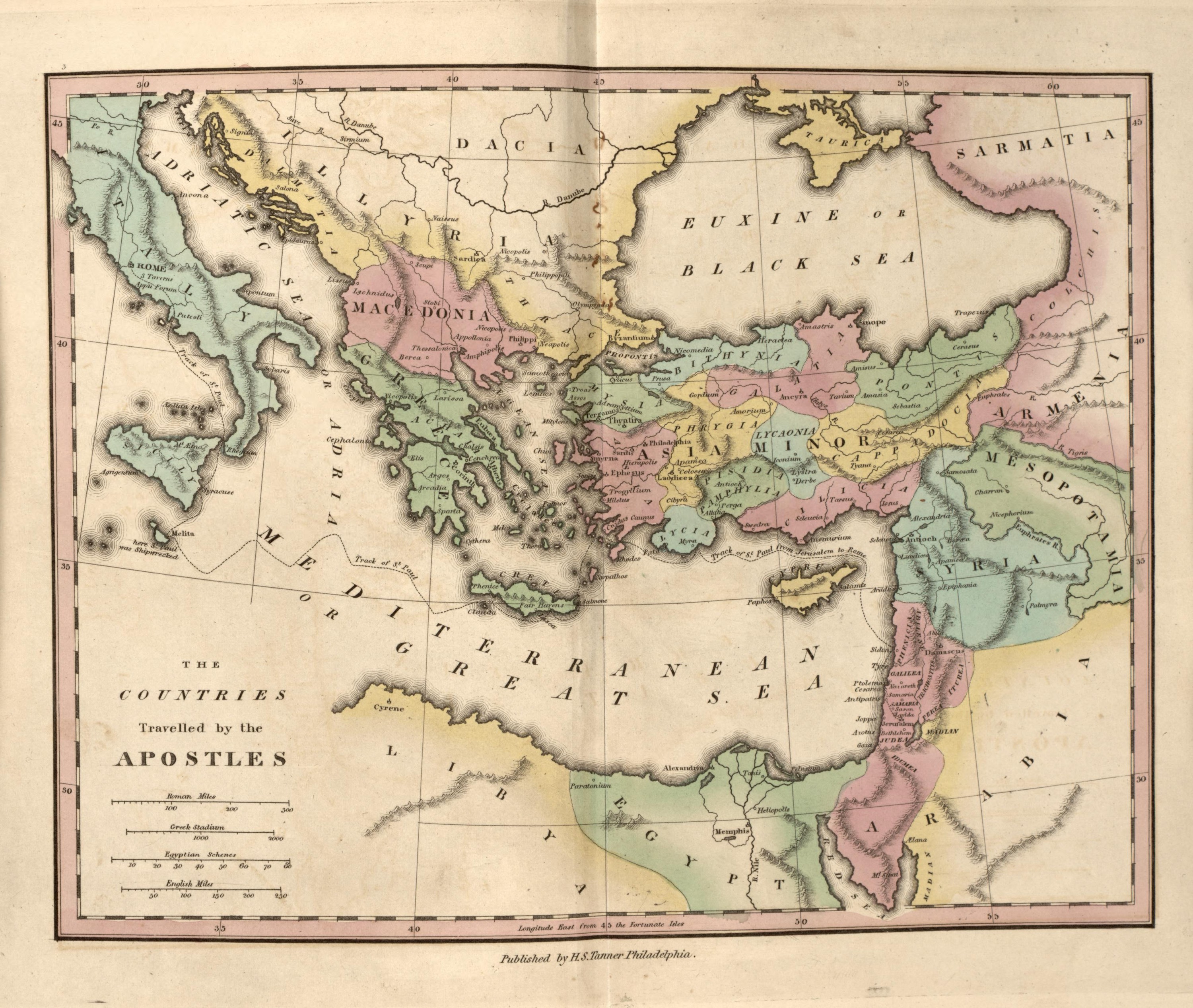
The countries travelled by the Apostles Mapmaker: Tanner, Henry Schenck · Year: 1826
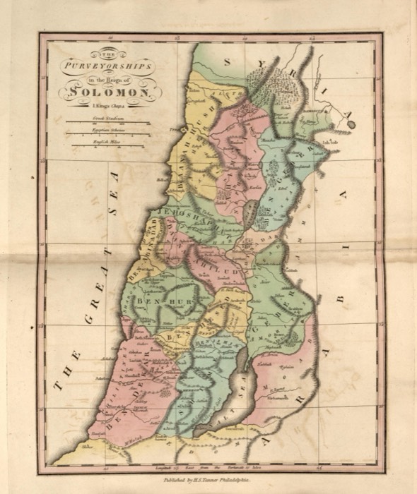
From «An Atlas of Ancient Geography», published by Henry S. Tanner in Philadelphia in 1826 «to elucidate the writings of the ancient authors, both sacred and profane». The plate spans the Roman world from Italy to Mesopotamia; a dotted line marks the voyage of Paul from Jerusalem to Rome, with the note at Malta that «here St. Paul was shipwrecked».
The map at the Library of Congress
Old maps of the Holy Land, 1600–1881: Library of Congress, Geography and Map Division (public domain; item numbers found through Wikimedia Commons, images from the library’s own server); the texts are ours
Passages Acts 27:1–44 When it was decided that we would sail for Italy, Paul and some other prisoners were handed over to a centurion named Julius, who belonged to the Imperial Regiment. We boarded an Adramyttian ship about to sail for ports along the coast of Asia, and we put out to sea. Aristarchus, a Macedonian from Thessalonica, was with us. The next day we landed at Sidon, and Julius treated Paul with consideration, allowing him to visit his friends and receive their care. After putting out from there, we sailed to the lee of Cyprus because the winds were against us. And when we had sailed across the open sea off the coast of Cilicia and Pamphylia, we came to Myra in Lycia. There the centurion found an Alexandrian ship sailing for Italy and put us on board. After sailing slowly for many days, we arrived off Cnidus. When the wind impeded us, we sailed to the lee of Crete, opposite Salmone. After we had moved along the coast with difficulty, we came to a place called Fair Havens, near the town of Lasea. By now much time had passed, and the voyage had already become dangerous because it was after the Fast. So Paul advised them, “Men, I can see that our voyage will be filled with disaster and great loss, not only to ship and cargo, but to our own lives as well.” But contrary to Paul’s advice, the centurion was persuaded by the pilot and by the owner of the ship. Since the harbor was unsuitable to winter in, the majority decided to sail on, if somehow they could reach Phoenix to winter there. Phoenix was a harbor in Crete facing both southwest and northwest. When a gentle south wind began to blow, they thought they had their opportunity. So they weighed anchor and sailed along, hugging the coast of Crete. But it was not long before a cyclone called the Northeaster swept down across the island. Unable to head into the wind, the ship was caught up. So we gave way and let ourselves be driven along. Passing to the lee of a small island called Cauda, we barely managed to secure the lifeboat. After hoisting it up, the crew used ropes to undergird the ship. And fearing that they would run aground on the sandbars of Syrtis, they lowered the sea anchor and were driven along. We were tossed so violently that the next day the men began to jettison the cargo. On the third day, they threw the ship’s tackle overboard with their own hands. When neither sun nor stars appeared for many days and the great storm continued to batter us, we abandoned all hope of being saved. After the men had gone a long time without food, Paul stood up among them and said, “Men, you should have followed my advice not to sail from Crete. Then you would have averted this disaster and loss. But now I urge you to keep up your courage, because you will not experience any loss of life, but only of the ship. For just last night an angel of God, whose I am and whom I serve, stood beside me and said, ‘Do not be afraid, Paul; you must stand before Caesar. And look, God has granted you the lives of all who sail with you.’ So take courage, men, for I believe God that it will happen just as He told me. However, we must run aground on some island.” On the fourteenth night we were still being driven across the Adriatic Sea. About midnight the sailors sensed they were approaching land. They took soundings and found that the water was twenty fathoms deep. Going a little farther, they took another set of soundings that read fifteen fathoms. Fearing that we would run aground on the rocks, they dropped four anchors from the stern and prayed for daybreak. Meanwhile, the sailors attempted to escape from the ship. Pretending to lower anchors from the bow, they let the lifeboat down into the sea. But Paul said to the centurion and the soldiers, “Unless these men remain with the ship, you cannot be saved.” So the soldiers cut the ropes to the lifeboat and set it adrift. Right up to daybreak, Paul kept urging them all to eat: “Today is your fourteenth day in constant suspense, without taking any food. So for your own preservation, I urge you to eat something, because not a single hair of your head will be lost.” After he had said this, Paul took bread and gave thanks to God in front of them all. Then he broke it and began to eat. They were all encouraged and took some food themselves. In all, there were 276 of us on board. After the men had eaten their fill, they lightened the ship by throwing the grain into the sea. When daylight came, they did not recognize the land, but they sighted a bay with a sandy beach, where they decided to run the ship aground if they could. Cutting away the anchors, they left them in the sea as they loosened the ropes that held the rudders. Then they hoisted the foresail to the wind and made for the beach. But the vessel struck a sandbar and ran aground. The bow stuck fast and would not move, and the stern was being broken up by the pounding of the waves. The soldiers planned to kill the prisoners so none of them could swim to freedom. But the centurion, wanting to spare Paul’s life, thwarted their plan. He commanded those who could swim to jump overboard first and get to land. The rest were to follow on planks and various parts of the ship. In this way everyone was brought safely to land. Acts 28:1 Once we were safely ashore, we learned that the island was called Malta.