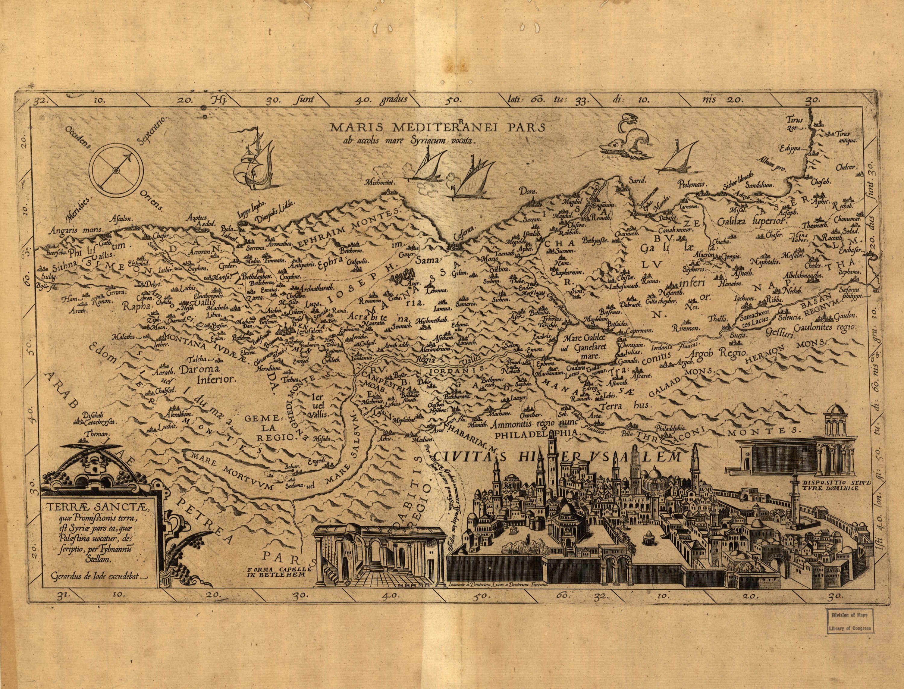
A map of the Promised Land drawn by the German scholar Tilemann Stella and published in Antwerp by Gerard de Jode. The coast runs along the top, so west is up, and the land is divided among the tribes of Israel. Along the bottom edge runs a view of Jerusalem, with the chapel in Bethlehem on the left and the chapel over the Holy Sepulchre on the right.
Old maps of the Holy Land, 1600–1881: Library of Congress, Geography and Map Division (public domain; item numbers found through Wikimedia Commons, images from the library’s own server); the texts are ours