Old maps · c. 1730
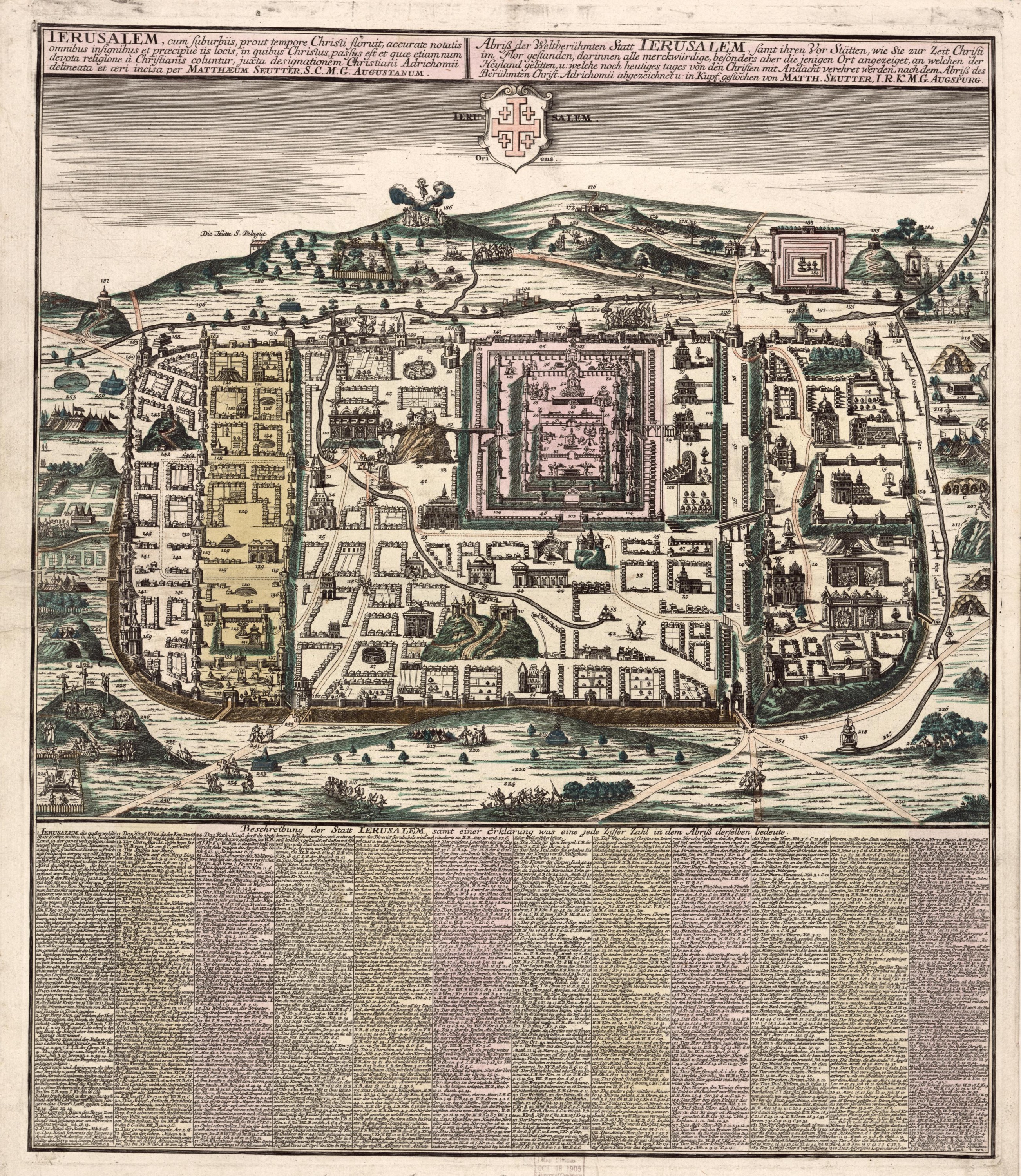
Jerusalem in the time of Christ, by Matthäus Seutter
Mapmaker: Seutter, Matthaeus; Adrichem, Christiaan Van · Year: c. 1730
The Augsburg engraver Matthäus Seutter redrew the plan of Jerusalem made in 1584 by the Dutch priest Christiaan van Adrichem, who reconstructed the city from the Bible and Josephus without ever travelling there. More than two hundred numbered buildings and places are explained in the German key below, and the cross of Jerusalem stands above the city.
The map at the Library of Congress
Old maps of the Holy Land, 1600–1881: Library of Congress, Geography and Map Division (public domain; item numbers found through Wikimedia Commons, images from the library’s own server); the texts are ours