Explore › Old maps › The travels of St. Paul
Open the map in full size (3000 × 2256)Library of Congress, Geography and Map Division · public domain Old maps · 1881
The travels of St. Paul Mapmaker: H.H. Hardesty (Firm) · Year: 1881
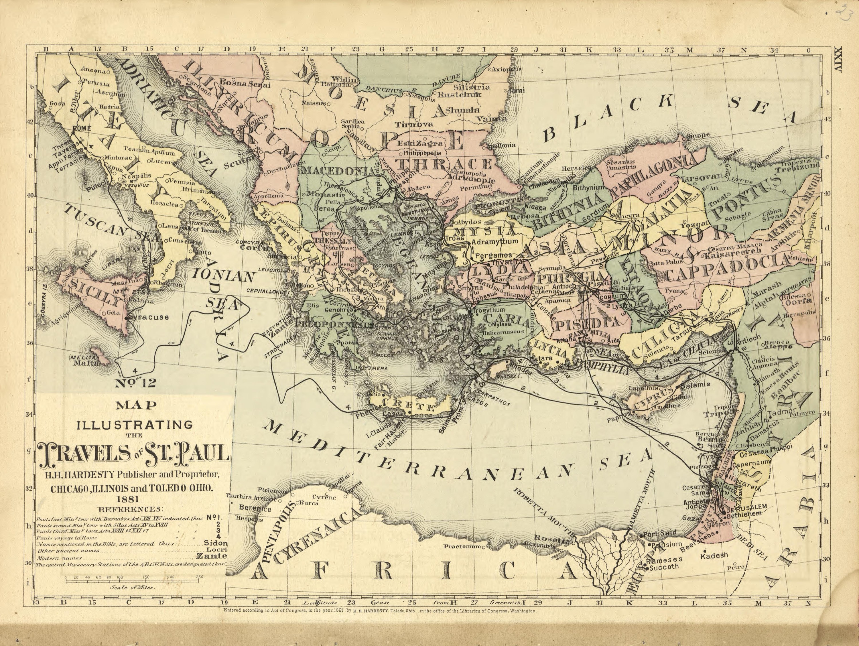
From the «Historical Hand-Atlas» published by H. H. Hardesty in Chicago and Toledo in 1881, which includes a numbered series of Bible maps. Map No. 12 numbers Paul's three missionary journeys and his voyage to Rome, each with its chapters of Acts, and also marks the mission stations of an American missionary society of 1881.
The map at the Library of Congress
Old maps of the Holy Land, 1600–1881: Library of Congress, Geography and Map Division (public domain; item numbers found through Wikimedia Commons, images from the library’s own server); the texts are ours
Passages Acts 13:1–4 Now in the church at Antioch there were prophets and teachers: Barnabas, Simeon called Niger, Lucius of Cyrene, Manaen (who had been brought up with Herod the tetrarch), and Saul. While they were worshiping the Lord and fasting, the Holy Spirit said, “Set apart for Me Barnabas and Saul for the work to which I have called them.” And after they had fasted and prayed, they laid their hands on them and sent them off. So Barnabas and Saul, sent forth by the Holy Spirit, went down to Seleucia and sailed from there to Cyprus. Acts 16:9–12 During the night, Paul had a vision of a man of Macedonia standing and pleading with him, “Come over to Macedonia and help us.” As soon as Paul had seen the vision, we got ready to leave for Macedonia, concluding that God had called us to preach the gospel to them. We sailed from Troas straight to Samothrace, and the following day on to Neapolis. From there we went to the Roman colony of Philippi, the leading city of that district of Macedonia. And we stayed there several days. Acts 27:1–2 When it was decided that we would sail for Italy, Paul and some other prisoners were handed over to a centurion named Julius, who belonged to the Imperial Regiment. We boarded an Adramyttian ship about to sail for ports along the coast of Asia, and we put out to sea. Aristarchus, a Macedonian from Thessalonica, was with us.